On our last day here, we did another day-long tour, this one being a bus trip all around the lake, so with 10 other folks, we boarded the van at Black Coffee at 7:45 and off we went. Why take a trip around the lake on our last day here? Well, it was supposed to occur during our first week, so we could get more of a sense of our location, but Julie’s back injury made it impossible for us to go on that trip, so we packed a day early, left our suitcases in our casa, and off we went.

First, though, let's review a few of the facts from the blog post on the lake itself. At 5000 feet above sea level, it’s a huge lake, about 50 miles long from east to west and about 10-15 miles wide from north to south, thus covering about 420 square miles. Lots of shoreline, and it’s shallow, with a mean depth of 23 feet and a maximum depth of 34 feet. The lake level also fluctuates dramatically, and in 2001-02, they were afraid it was going to go dry, but ample rains in 2003 helped fill it up again, but when I say fill it up, I mean at about 60% capacity, which is what it seems to have been at the past few years.
Here are a few shots of the lake from various angles along our journey:
 |
| the island of Mezcala, sometimes called Presidio, the largest of the 3 islands on the lake. It was the site of a famous rebellion against the Spaniards and then became a prison. |
 |
| Mezcala Island |
So now that we have reviewed a bit about what the lake itself is like, let’s talk about what surrounds the lake — all 184 miles around the lake.
184 miles takes a long time, especially with stops. We began our trek to the Black Coffee meeting place at 6:50 am, yes, in the morning! We walked, and it was a lovely walk. Our bus (12 on board) left at 7:47 am. Long day? Yes, we returned home at 5:30, but it was a good day.
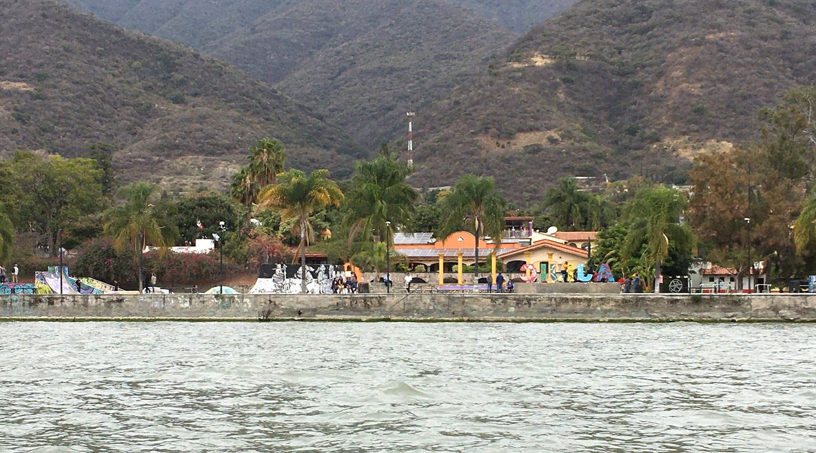
We hadn’t really felt like we were living in Mexico during our month in Ajijic since there are so many ex-pats. We saw “Mexico” on our trip around Lake Chapala, both the large cities, the small villages, and the countryside in between. And we saw the lake too! Here a a few of the road shots.
We headed East, driving clockwise around the lake. We drove straight through Chapala, Ajijic's "mother" city, and then saw a couple of the largest cities around the lake: Poncitlan and Ocotlan. The “itlan” ending is quite common in this area. It means “place of,” and "ponce" means cactus, so Poncitlan is the place of cactuses (or cacti). These two cities seemed quite prosperous and apparently form the hub of the furniture industry in Mexico. There were tons of furniture factories and stores on the route. Additionally, Nestles has a couple of huge chocolate factories in the area. We stopped in Ocotlan and wandered around the town plaza; we also saw the church.
 |
| a very famous kind of bread -- poncipan -- is made in Poncitlan |
 |
| always pretty town plazas |
 |
| the eagle and the snake -- the symbol of Mexico (also on the flag) |
 |
| paying homage to the furniture manufacturers in the area |
 |
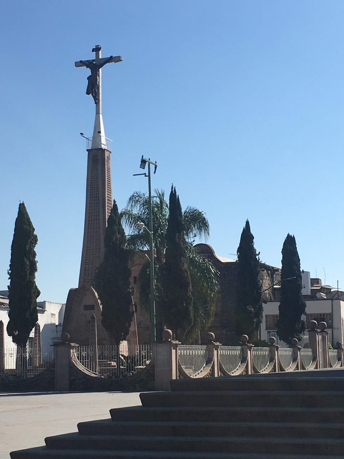
| bad earthquake in 1847 toppled the church |
 |
| a few days later several people saw Jesus in the sky at the location of this cross, a miracle they claimed |
A bit more about names of cities/villages. Several of them begin with a saint's name like "San Juan Cosala." Cosala is the original name, but when the Spanish arrived, they added a saint's name to the village name.
 |
| note the combo of the saint's name (San Pedro) with the original name (Itzican) |
In contrast to the large cities, we saw many smaller villages, and we drove through the main streets of a couple of them. There was some poverty and lots of happiness from what we could tell. We drove through one village where the kids were just going to school. Uniforms are required in Mexico, so all the kids had on uniforms, and the girls’ hair was all done to perfection, a noticeable element in every location we’ve been in. The bow industry must do very well in Mexico! Every girl has one (or two), and they are huge and lovely. Here are a few pictures of the small villages we drove through.
 |
| always street decorations in the smaller villages |
 |
| preferred mode of construction was these reddish bricks |
We had lunch close to La Barca (a somewhat unremarkable restaurant but okay) and were told that La Barca is at the far east end of the lake, and the lake is the longest from east to west. What was most evident was that the lake we saw from Ajijic was a only small portion of the lake. One of the towns we passed through had their "make-your-own taco" stand set up. Looked delicious:
 |
| La Barca is also the location of the river Lerma, one of the five rivers feeding into the lake and the most polluted river |
After La Barca, we stopped at a town that had a decent archeological museum. We were delighted to find a group of early elementary age children leaving the museum just as we arrived.
 |
| uniforms are required in all Mexican schools. School is free, but families must pay for the uniforms. |
 |
| All the little girls had these beautiful huge bows in their hair. |
Several communities had these heart-shaped containers in the town plaza (including Ajijic). People put plastic bottle caps in them, and they are recycled so that children with cancer can get "free" chemotherapy. Some of the ex-apts on our tour were working on this project in Ajijic, and they even collecting bottle caps from people back in their summer home in Canada.
Next stop was a small fishing town called Patapan. This town was a delight. The men fished, and the women (and some men) cleaned the fish — all day long. LOTS of fish, much of it tilapia, but also some cat fish. The kids put the entrails of the fish in their buckets and since tourists were stopping at this village all day long, the tourists would pay the kids to toss their buckets to the hundreds of huge white pelicans that stay in the area from October to March.
On the south side of the lake, the fruits and vegetables are grown. Driscoll's has a large presence here, and as we sit on our mirador (patio), we had been wondering what those huge rectangular whitish things were across the lake from us. Well, they are white plastic "blankets" covering mostly raspberries and blueberries to protect the fruits from birds, but also from hail.
Jocotepec is the town on the far west end of the lake, opposite La Barca on the east. Although we did not stop here, we got a flavor of the place just from driving through. This is the area of the natural hot springs, and there are a number of fancy resorts advertising their springs and there are a ton of restaurants, all fancy and all excellent given the comments from people on our tour.
And some final shots of a cemetery. While it is not the time of the Day of the Dead celebration in Mexico, the cemeteries were still decorated. Quite festive looking!
We are glad we got the chance to do the tour, even though we couldn’t do it at the beginning of our stay.